
Ports

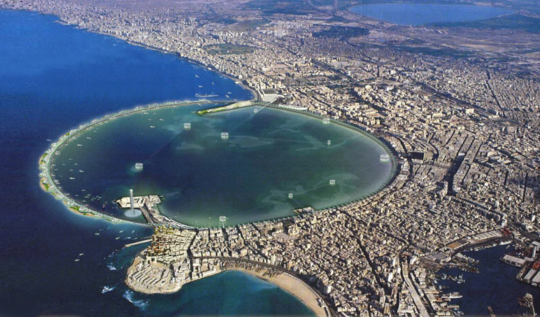
Alexandria port
The port of Alexandria is the most important and largest port of the Arab Republic of Egypt in terms of trade volume, and through it about 60% of foreign trade is handled. The port is geographically divided into 9 regions, six of them in Alexandria Port, known as the Eastern Port, and three regions in Dekheila Port. As the port is used for commercial shipping, it also receives cruise ships and passenger ships.
longitude (29o 52′ E)
latitude (31o 11′ N)
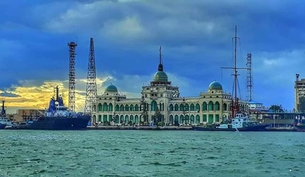
Port Said
Port Said port lies to the northern entrance of the Suez Canal. It is considered one of the most important Egyptian ports due to its distinctive location on the entrance of the most significant waterway in the world (The Suez Canal) and in the middle of the biggest merchant shipping line between Europe and the east. It is moreover the biggest transit port in the world.
Passing the Suez Canal has an important time and cost impact on a vessel’s voyage. Exact planning, early notification, constant follow-up and real cost control are needed to save your time and money.
Our experienced staff in Port Said monitors the traffic situation daily 24H/24H, which enables Fantasia Agency to keep you updated about general events and to track your vessels at anchorage and in transit.
As your partner, Fantasia team is committed to ensure the smooth transit of your vessels.
Latitude (31 degrees , 15 minutes N)
Longitude ( 32 degrees, 18 minutes E)
Suez
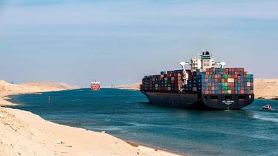
The Suez Canal is an artificial sea-level waterway running north to south across the Isthmus of Suez in Egypt to connect the Mediterranean Sea and the Red Sea. The canal separates the African continent from Asia, and it provides the shortest maritime route between Europe and the lands lying around the Indian and western Pacific oceans. It is one of the world’s most heavily used shipping lanes. The Suez Canal is one of the most important waterways in the world.
The canal is extensively used by modern ships , as it is the fastest crossing from the Atlantic Ocean to the Indian Ocean. On both sides of the Canal, there are mooring bollards every 125 m for the mooring of vessel in case of emergency, and kilometric sign posts helping locate the position of ships in the waterway. The navigable channel is bordered by light and reflecting buoys as navigational aids to night traffic.
longitude ( 32o 34′ E )
latitude ( 29o 56′ N )
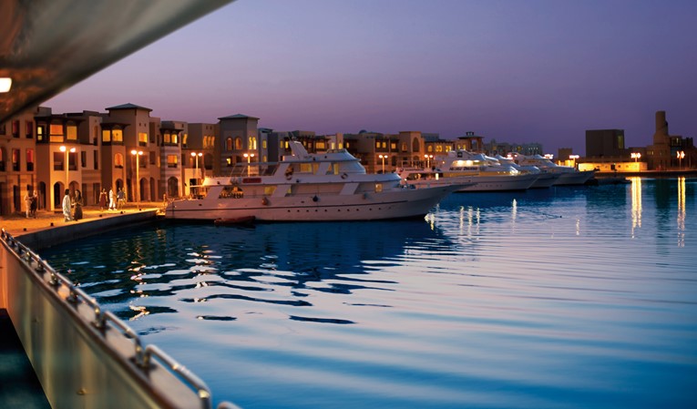
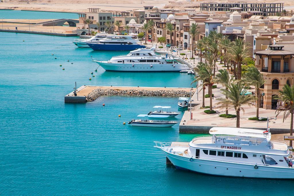
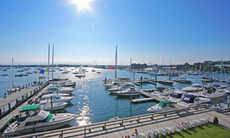
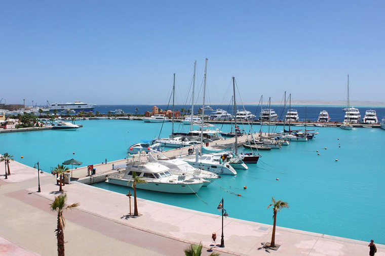
HURGHADA MARINA
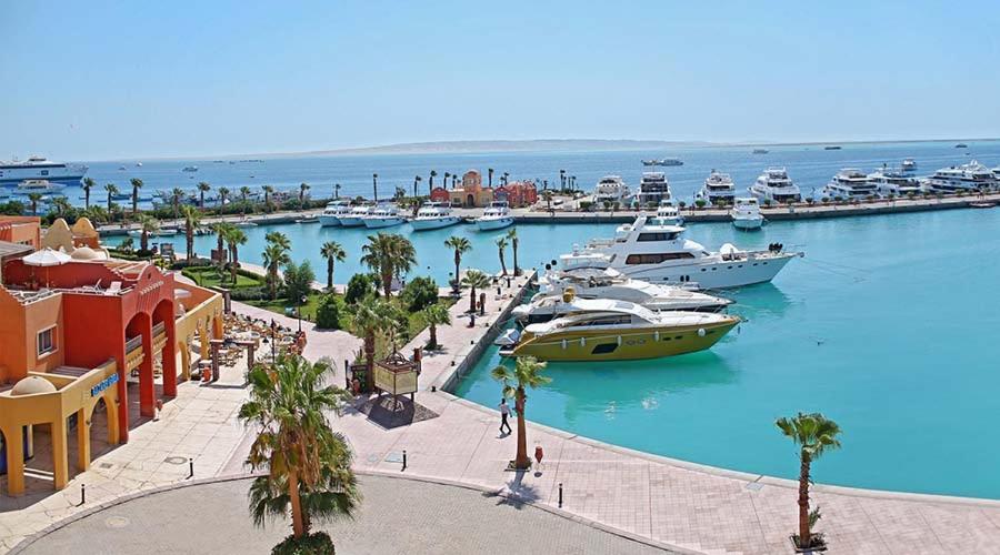
The port of Hurghada is one of the Egyptian ports affiliated to the General Authority for Red Sea Ports. It is located on the western coast of the Red Sea near the entrance to the Gulf of Suez, 370 km south of Suez.
The importance of the port is highlighted by its location, global tourism service in the Red Sea region, yacht tourism of all kinds, long-distance cruise ship tourism, as well as marine navigation lines to transport tourists and passengers from Saudi Arabia and the Gulf countries to the sea port of Sharm el-Sheikh
longitud (33o 53′ E)
latitud (27o 13.5′ N)
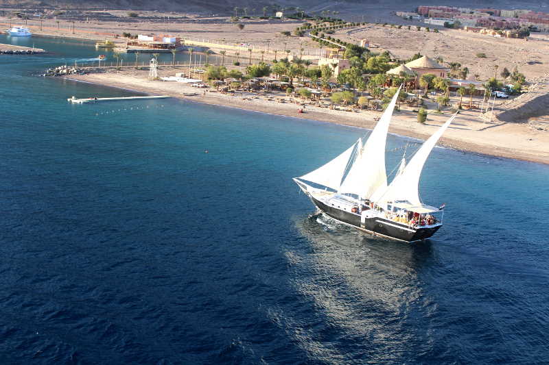
Sharm El Sheikh

The simplicity of sun, sea and sand. The luxury of five-star hotels, water sports, shopping and entertainment. This is Sharm el-Sheikh, one of the most accessible and developed tourist resort communities on the Sinai peninsula. All around are Bedouins, colorful tents, mountains and sea. There are small, intimate hotels with modern designs, as well as larger hotel complexes belonging to International chains, plus about all the amenities one could expect of a tourist center, including casinos, discos and nightclubs, golf courses and health facilities. In fact, with diving and snorkeling, windsurfing and other water sports, horses and camel riding, desert safaris, and great nearby antiquities attractions, it is almost impossible for a visitor to ever suffer from boredom. A glittering beachfront city, Sharm-El-Sheikh has become a premium yachting destination due to its fantastic location on the southern tip of the Sinai Peninsula, surrounded by sublime beaches, world-class diving, vibrant nightlife and opulent resorts.
longitude ( 34o 17′ E )
latitude (27o 51.2′ N)
MARSA ALAM
Marsa Alam is situated near the Tropic of Cancer where the Arabian Desert meets the Red Sea, and it has the appearance of a tropical paradise with its palm trees, mangroves and sea coasts fringed with barrier coral reefs. It has already gained a strong reputation amongst scuba divers due to its numerous and unspoilt diving sites both along the coast and offshore. Sightings of spinner dolphins, dugongs and hammerhead sharks are a frequent occurrence for those who venture into its waters.
Marsa Alam also has some inland attractions, such as the Emerald Mines and the Temple of Seti I at Khanais, near also is Marsa Alam Airport.
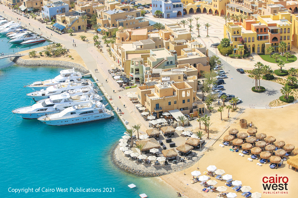
el Gouna
Drop anchor in El Gouna, where two marinas and a pristine harbor town offer seafarers the Red Sea’s best in service, comfort and style. Boasting multiple marinas, comprehensive services, and an aesthetically unified harbor town designed by Italian architect Alfredo Freda, El Gouna has quickly become a favorite docking place for pleasure craft traversing the Red Sea. A designated International Point of Entry, Abu Tig is in a league of its own among Red Sea marinas both for the high standard of services it provides as well as for its matchless backdrop: a harbor town that is not only architecturally praiseworthy but also offers El Gouna’s most exclusive shopping and dining. Abu Tig Marina town is just part of the world class touristic resort – El Gouna, which in itself is now a well established resort development complete with its own infrastructure including; power stations, water treatment plants, many international hotel chains, golf course, airport, hospital, school, shops, etc.
The marina town contains two 4 star hotels, three smaller hotels, restaurants, cafes, bars, shops, and the marina South and North basin (yacht harbour) and was the first of its kind in the Red Sea.
Longitude ( 40.94 33o S)
Latitude ( 24.61 27o sh )
Port Ghalib International
Marsa Port Ghalib is located on the Red Sea coast between the cities of Quseir and Marsa Alam, 75 km south of Quseir, 65 km north of Marsa Alam, and 4 km south of Marsa Alam International Airport.
Port Ghalib Marina is an official entry port for Egyptian lands, and a first entry gate to Egypt from the southern border for yachts passing from the Far East towards yacht ports in the Mediterranean.
Longitude ( 30.38 34o s )
Latitude ( 32.25 25o u )
Porto Marina El Alamein
Porto Marina El Alamein is located on the Mediterranean coast, about 100 km from Alexandria.
It serves Marina El Alamein Tourist Resort and is considered the closest place to the important archaeological and historical areas that lure the European market.
It is the only port equipped with berths suitable for yacht tourism in the Mediterranean.
Longitude ( 59.8 28o s )
Latitude ( 49.5 30o u )
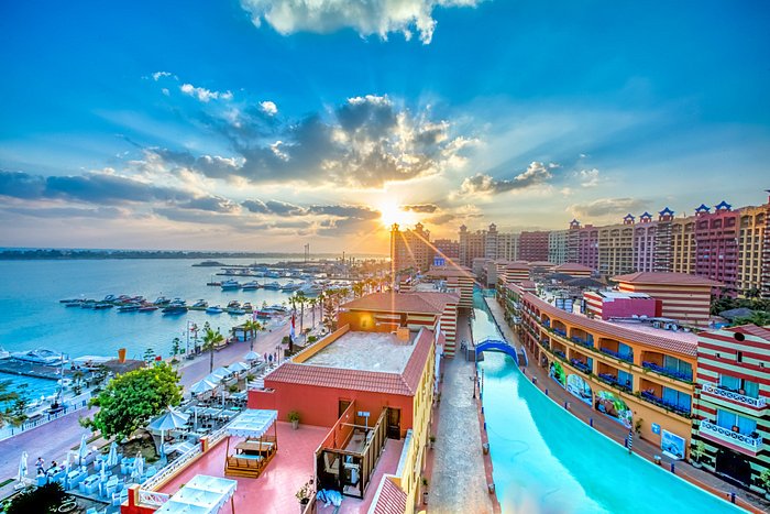
Marina Soma Bay
Soma Bay is a tourist resort on the Red Sea coast of Egypt, 45 km south of Hurghada International Airport.
The area surrounding the resort is about 10 million square meters, which is the Soma Bay peninsula, which is almost completely surrounded by sea water.
There are several features in Soma Bay, including diving sports, a group of houses and villas overlooking the beach, and various sites for coral reefs. The resort includes five main sites (Sheraton, Casades Golf Resort, Robinson Club, Kempinski Hotel, and Breakers Diving Resort). There are also large areas for the resort’s golf club, which has 18 holes. And there is a golf academy, which hosted several tournaments for the game, some of which were organized by “Gary Player”, a professional golfer from South Africa
Longitude ( 03.93 59 33 o s )
Latitude ( 59.33 50 26o s )
Marina Taba Heights Tourist
Taba Sea Port is a tourist sea port that began as a small marina for yachts on June 5, 2005, and has been developed into an integrated commercial and tourist port from which yacht cruises depart to the Jordanian port of Aqaba. The Red Sea Ports Authority owns 51% of the port, and the port is managed by a joint stock company with Taba Heights and Taba Hotels, which are owned by Orascom Development Egypt. The port works to activate the tourism process in the region by receiving tourist delegations coming to the city of Taba from the port of Aqaba, which contributes to reviving the tourism movement in Egypt.
Longitude ( 03.93 59 , 330 S )
Latitude ( 59.33 50 , 260 S )
Hurghada Marina
Hurghada’s tourist marina is located next to the fishermen’s village in the Sakkala area. It is bordered to the east by the Red Sea, to the north by the fishing port and the fish ring, to the south by vacant land and the public beach of the governorate, and to the west by an asphalt road.
Longitude ( 59.8 28o s )
Latitude ( 49.5 30o u )